
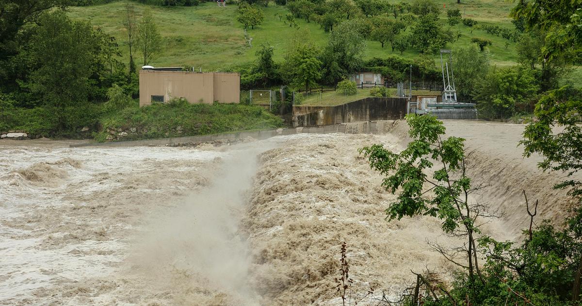
New disturbance approaching Italy with many clouds that over the next few hours will bring the first scattered rains: the third weekend of May will be marked by unstable or disturbed weather conditions on most of the peninsula. This is the scenario drawn by the Italian Weather Center: eyes focused on the North-West with accumulations even over 150 mm on Piedmont but abundant rainfall could also affect Calabria, Sicily and Sardinia.
For today a lot of cloudiness is expected in the North, in the morning, in transit over all regions with scattered rain in the North-West and dry elsewhere. In the afternoon instability increasing with rain and downpours scattered over all regions, drier on the Adriatic sectors. In the evening no significant changes are expected with rains still on the same sectors, more intense on Piedmont.
In the Center, in the morning, many clouds in transit over all regions but with dry weather, except for isolated rains over Tuscany. In the afternoon increasing instability with scattered rain in inland areas and dry variability elsewhere. In the evening cloudiness increasing with scattered rains on the Tyrrhenian side, dry with cloudy skies over Marche and Abruzzo.
In the South and in the Islands, scattered rains on Sardinia, in the morning with dry variability elsewhere with wide spaces of clear between Sicily, Calabria and southern Puglia. In the afternoon there are no significant variations with rain on Sardinia and dry elsewhere with irregular cloudiness. Between the evening and the night rains in extension on Sicily and Tyrrhenian regions. Minimum temperatures slightly decreasing in the central regions and increasing in the North, South and on the major islands; peaks decreasing in the North and on Sardinia, slightly increasing on the rest of Italy.